Mount Kenya has multiple valleys that radiate from its
peaks. The major valleys of Mt. Kenya are Gorges Valley, Hobley Valley, Hinde
Valley, Northey Valley, Tyndall Valley, Hausberg Valley, Mackinder Valley,
Teleki Valley, and Hohnel Valley.
These valleys separate the glaciers and different peaks and
points on the mountain, creating distinct landscapes and diverse ecosystems.
Understanding the significance and characteristics of each valley can enhance
the experience of exploring Mount Kenya, whether for adventure or study.
Principal Valleys of Mount Kenya
Mount Kenya boasts several principal valleys, each with unique features and historical significance. Here is an overview of the main valleys:
- Gorges Valley: Gorges Valley is known for its dramatic landscapes and steep cliffs. This valley provides challenging terrain for experienced hikers and offers breathtaking views of the surrounding peaks and glaciers.
- Hobley Valley: Hobley Valley is named
after the British colonial administrator Charles Hobley. It is characterized by
its lush vegetation and the presence of several small streams that contribute
to the area's biodiversity.
- Hinde Valley: Hinde Valley, named after
Sidney Langford Hinde, a British explorer, features a variety of flora and
fauna. It is a popular spot for botanists and wildlife enthusiasts who are
interested in studying the region's ecosystem.
- Northey Valley: Northey Valley is noted
for its scenic beauty and tranquil environment. It is less frequented by
tourists, making it an ideal location for those seeking solitude and a deeper
connection with nature.
- Tyndall Valley: Tyndall Valley is named
after the physicist John Tyndall. This valley is notable for its glacial
formations and serves as a significant area for geological studies and glacier
observation.
- Hausberg Valley: Hausberg Valley offers a
mix of rugged terrain and picturesque landscapes. It is a favorite among
climbers who are looking for a challenging ascent and panoramic views.
- Mackinder Valley: Mackinder Valley,
detailed in the provided notes, is a key route for hikers. It is characterized
by its giant lobelia and groundsels plants, Liki North River, and Shipton’s
Camp. The valley is situated at the foot of the three highest peaks of Mount
Kenya: Batian, Nelion, and Lenana.
- Teleki Valley: Teleki Valley, also
detailed in the notes, offers a bird’s eye view from Point Lenana and features
landmarks such as the Lewis Glacier, Curling Pond, and the Austrian Hut. It is
named after Count Samuel Teleki, who led an expedition into the valley in 1887.
- Hohnel Valley: Hohnel Valley is named
after Ludwig von Höhnel, an Austrian naval officer and explorer. The valley is
known for its rugged terrain and the presence of rare alpine plants.
Mackinder's Valley
Mackinder's Valley is one of the most prominent and
historically significant valleys on Mount Kenya. This valley is a common route
for hikers climbing the mountain from the Sirimon Gate in Nanyuki town or
descending from the Chogoria route. It is named after Halford Mackinder, who
made the first recorded ascent of Batian, the highest peak on Mount Kenya, in
1899.
Significance and Unique Features
Mackinder's Valley is distinguished by its unique flora and
fauna, including giant lobelia and groundsels plants that create a striking
landscape. The valley is also home to the Liki North River, which flows through
the area, adding to its natural beauty.
Hikers often camp at Shipton’s Camp, located at the foot of
Mount Kenya's three highest peaks: Batian, Nelion, and Lenana.
Historical Background
The valley's name honors Halford Mackinder, a pioneering
British geographer and mountaineer. Mackinder's expedition in 1899 marked a
significant achievement in the history of mountaineering, as he successfully
reached the summit of Batian, standing at 5,199 meters.
This accomplishment established Mackinder's Valley as an
essential route for those aiming to conquer the peaks of Mount Kenya.
Route and Landmarks
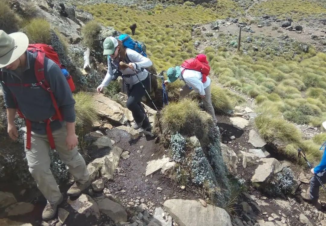
Mackinder's Valley serves as a vital passage for climbers.
The route from Sirimon Gate takes hikers through diverse landscapes, including
forests, moorlands, and alpine zones. Along the way, adventurers can enjoy
breathtaking views of the surrounding peaks and glaciers.
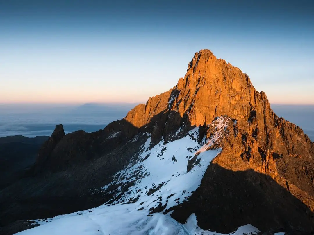
The proximity to the highest peaks makes this valley a
strategic point for acclimatization and preparation before attempting to summit
Batian, Nelion, or Lenana.
Teleki Valley
Teleki Valley is another significant valley on Mount Kenya,
known for its stunning landscapes and historical importance. Named after Count
Samuel Teleki, who led the first expedition to penetrate the forest zone of
Mount Kenya in 1887, Teleki Valley offers a unique combination of natural
beauty and historical relevance.
Bird’s Eye View and Landmarks
A bird’s eye view of Teleki Valley from Point Lenana reveals
a breathtaking panorama of the area. In the foreground, hikers can see the tip
of Lewis Glacier, a remnant of the once extensive glacial cover on Mount Kenya.
To the left of the valley is Curling Pond, accompanied by
the Austrian Hut, a popular shelter for climbers. To the right is the southeast
ridge connecting Point John to Nelion, although this is hidden from view from
Point Lenana.
Historical Background and Count Samuel Teleki
Teleki Valley is named in honor of Count Samuel Teleki, a
Hungarian explorer who led a pioneering expedition into the valley. In 1887,
Teleki and his team became the first Europeans to penetrate the forest zone of
Mount Kenya, marking a significant milestone in the exploration of the
mountain.
His contributions to the exploration and understanding of
Mount Kenya's geography have left a lasting legacy, with the valley serving as
a testament to his adventurous spirit.
Route and Landmarks
Teleki Valley is accessible via several routes, with Point
Lenana being a popular starting point. The valley's landscape is dominated by
the presence of the Lewis Glacier, providing a striking contrast to the rugged
terrain.
Hikers often rest at the Austrian Hut, located at the edge
of the Curling Pond, before continuing their ascent. The valley's strategic
location makes it an essential stop for those aiming to explore the southeast
ridge and the peaks beyond.
Unique Features of Each Valley
Each valley on Mount Kenya boasts its own unique features,
contributing to the mountain's diverse ecosystem and stunning landscapes.
Here is an overview of what makes each valley special
|
Valley |
Access
Points |
Popular
Routes |
Key
Features |
|
Gorges
Valley |
Sirimon Gate |
Steep cliffs,
deep gorges, rich biodiversity |
|
|
Hobley
Valley |
Chogoria Gate |
Chogoria
Route |
Lush
vegetation, dense forests, numerous streams |
|
Hinde
Valley |
Naro Moru
Gate |
Naro Moru
Route |
Rare alpine
plants, diverse wildlife, research opportunities |
|
Northey
Valley |
Sirimon Gate |
Sirimon Route |
Scenic
beauty, tranquil environments, ideal for photography |
|
Tyndall
Valley |
Naro Moru
Gate |
Naro Moru
Route |
Significant
glacial formations, geological interest |
|
Hausberg
Valley |
Chogoria Gate |
Chogoria
Route |
Rugged terrain,
challenging paths, stunning panoramic views |
|
Mackinder
Valley |
Sirimon Gate |
Sirimon
Route, Chogoria Route |
Historical
significance, giant lobelia, groundsels, diverse wildlife |
|
Teleki
Valley |
Naro Moru
Gate |
Naro Moru
Route, Teleki Valley Route |
Lewis
Glacier, Curling Pond, Austrian Hut, historical background |
|
Hohnel
Valley |
Chogoria Gate |
Chogoria
Route |
Rugged
landscapes, rare alpine plants, exploration history |
Cultural and Historical Importance
The valleys of Mount Kenya hold profound cultural and
historical significance for the local communities and play a crucial role in
the mountain's rich heritage.
Cultural Significance
Mount Kenya is sacred to the Kikuyu, Meru, and Embu tribes.
According to Kikuyu mythology, the mountain is the dwelling place of Ngai, the
supreme deity. The Kikuyu people believe that Ngai created the mountain as an
earthly home to watch over and bless his people.
Traditional rituals, ceremonies, and offerings are conducted
at the base of the mountain to seek guidance and blessings from Ngai. The Meru
and Embu tribes also revere the mountain and perform similar rituals in its
sacred groves.
The cultural practices associated with Mount Kenya include
initiation ceremonies, such as circumcisions, which signify the transition from
adolescence to adulthood. Homes of the Kikuyu people are traditionally built
with their doorways facing the mountain, symbolizing respect and reverence for
the sacred site.
Historical Significance
Mount Kenya has a storied history of exploration and
significance in trade. Early European explorers, including Johann Ludwig Krapf,
were among the first to document the mountain in the mid-19th century.
Later, notable figures such as Halford Mackinder and Count
Samuel Teleki undertook significant expeditions that furthered the exploration
and understanding of the mountain's geography and ecology.
Historically, Mount Kenya served as a landmark for trade
routes, guiding caravans across East Africa. Its visibility and distinct
profile made it a crucial reference point for traders and explorers navigating
the region.
Additionally, the mountain influenced migration patterns,
with communities settling in its fertile surroundings.
Conservation and Modern Significance
Mount Kenya was designated a UNESCO World Heritage Site in
1997 due to its ecological, cultural, and historical importance. The mountain
supports a diverse range of flora and fauna, including several endemic species.
It also acts as a critical water catchment area, sustaining
nearly one-third of Kenya's population and contributing significantly to the
country's hydroelectric power supply.
Conservation efforts have been implemented to protect the mountain's forests and biodiversity. Despite challenges such as illegal logging and deforestation, ongoing initiatives aim to preserve the natural and cultural heritage of Mount Kenya for future generations.


